|
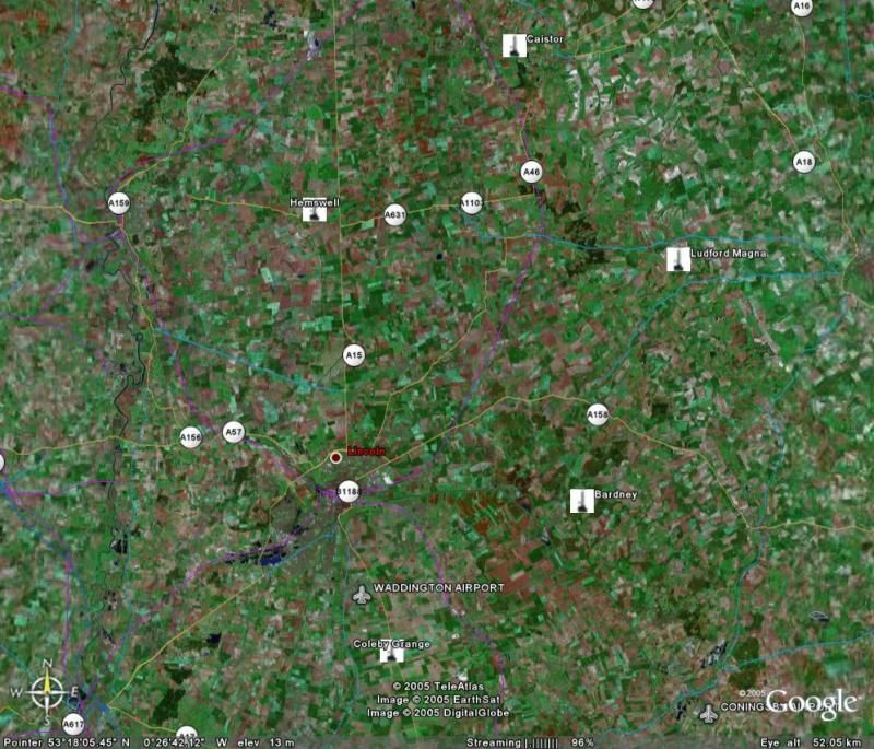
RAF Hemswell -No 97(SM) Squadron RAF 3 Thor IRBM launchers - Dec 1, 1959 - May 24, 1963.
|
|
RAF Ludford Magna -No 104(SM) Squadron RAF 3 Thor IRBM launchers-Jul 22, 1959 - May 24, 1963.
|
|
RAF Bardney -No 106(SM) Squadron RAF 3 Thor IRBM launchers - Jul 22, 1959 - May 24, 1963
|
|
RAF Coleby Grange - No 142(SM) Squadron RAF 3 Thor IRBM launchers - Jul 22, 1959 - May 24,
|
|
RAF Caistor -No 269(SM) Squadron RAF 3 Thor IRBM launchers - Jul 22, 1959 - May 24, 1963
|
|
The topography of Lincolnshire and other areas where sites were to be constructed were flat which necessitated the use of triangulation stations on elevated positions. Lincoln Cathedral was one of those used. The climb was up a
narrow spiral stone staircase which prevented the use of back packs, I forget
the actual number of steps but am sure that it was in excess of 200. The
theodolites, lamps and batteries had to be carried up in ones arms. I spent
many hours on the top light keeping. Other elevated trigs were on Church towers and water towers. Water towers required the surveyor to climb up a ladder usually under the tank, along a walkway and finally up a ladder on the outside of the tank. The tops were curved surfaces which required great care by the surveyor. On one well remembered occasion on e of our surveyors who shall for the time being remain anonymous thought that he had attached the tripod to a rope in order to lower it to the ground threw said tripod over the edge for it to go crashing to the ground, thanks to the RAF workshops a repair was completed. On the sites themselves it was often necessary to build a Bilby
Tower which could be constructed to a maximum of 105 feet. These towers
comprised two unconnected towers one inside the other. The inner tower was to
carry the instruments and the outside one the observing party. When light
keeping it was also necessary to carry the lead acid batteries to the top. We
did try using long electrical cable but the voltage drop was too great to
produce enough light at the lamp.
|
|
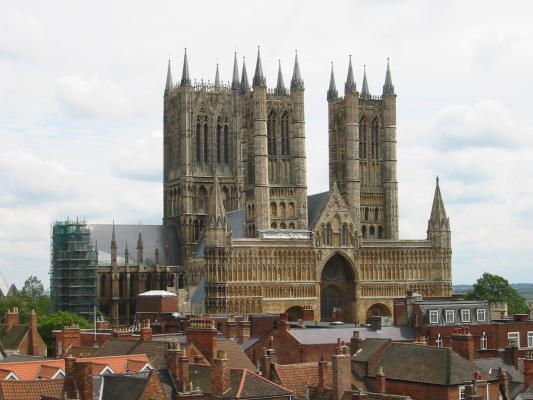
Reproduced with the kind permission of Jonathan Rawle http://jonathan.rawle.org/gallery This
was one of the elevated triangulation stations used |
|
|
|
©Crown copyright Ordnance Survey. Published with thanks to and the permission of Ordnance Survey
|
|
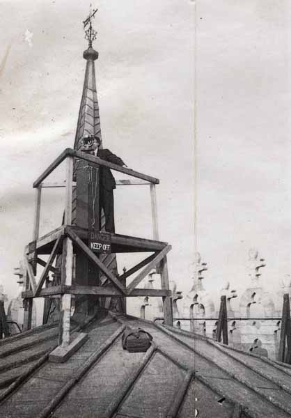
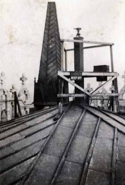
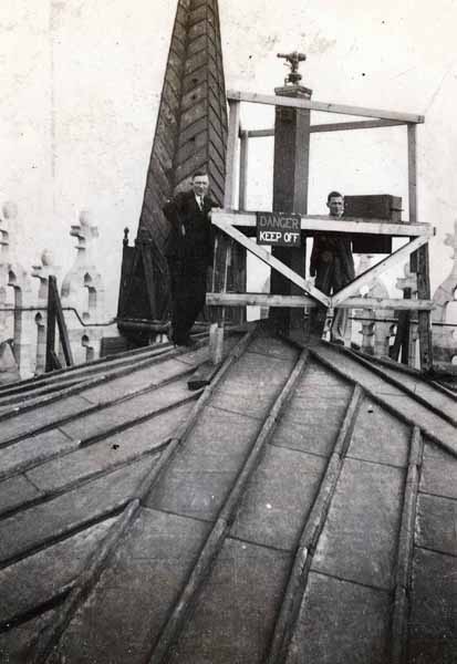
Geodetic Tavistock on top of Lincoln Minster
©Crown copyright Ordnance Survey. Published with thanks to and the permission of Ordnance Survey
|
|
Geodetic Tavistock on top of Lincoln Minster showing the observers platform
©Crown copyright Ordnance Survey. Published with thanks to and the permission of Ordnance Survey
|
|
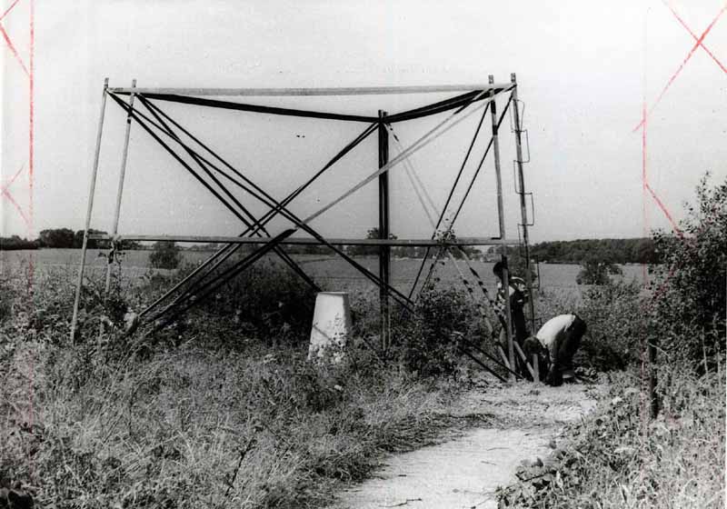
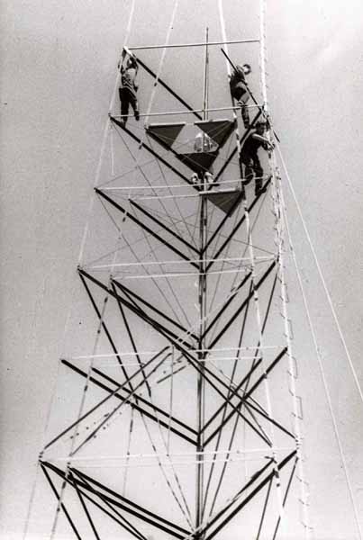
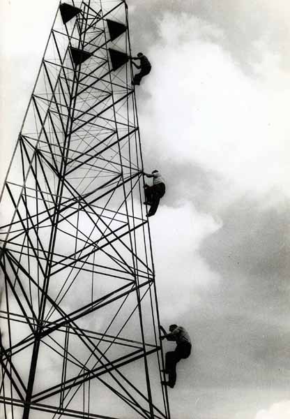
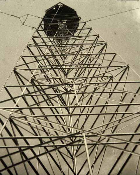
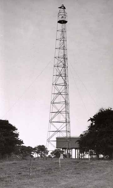
Bilby towers can be built o a height of 103 feet approximately 31.4 metres and are two independent towers, the inner tower is for the instrument and the outer to carry the observing party and their equipment I cannot find any photographs but thanks to the ORDNANCE SURVEY I can display photographs of Bilby Towers under construction & completed The Completed Tower is 103ft high, we never needed the full height and most were either 30ft or 60ft
We were trained in the construction of these towers by the Ordnance
Survey |
|
The
1st section of both the outer & inner towers
completed over a pillar
©Crown copyright Ordnance Survey. Published with thanks to and the permission of Ordnance Survey
|
|
Bilby Tower construction, nearing completion
©Crown copyright Ordnance Survey. Published with thanks to and the permission of Ordnance Survey
|
|
©Crown copyright Ordnance Survey. Published with thanks to and the permission of Ordnance Survey
|
|
Looking up the completed tower
©Crown copyright Ordnance Survey. Published with thanks to and the permission of Ordnance Survey
|
|
A distant view of the completed tower
©Crown copyright Ordnance Survey. Published with thanks to and the permission of Ordnance Survey
|